
Introduction to SpatiX's Innovative Surveying Solutions
In the ever-evolving landscape of geospatial technology, SpatiX.ai stands out as a pioneering force. By providing centimeter-level positioning, spatiotemporal intelligence, and high-precision positioning services, SpatiX is revolutionizing how we approach surveying, natural resource management, and urban development. Their cutting-edge devices, the H7 SLAM and X5 Laser RTK, are at the forefront of this transformation, bringing unparalleled accuracy and efficiency to professionals in Thailand and beyond.
Live Demonstrations in Thailand: A Success Story
Our recent visit to the Department of Nature in Thailand was nothing short of a triumph. The SpatiX team showcased the capabilities of the H7 SLAM and X5 Laser RTK through live demonstrations that left attendees in awe. The instant generation of laser point cloud data and the precise 3D modeling capabilities of our devices were particularly well-received. This successful demonstration highlighted the practical applications of our technology and its potentiax.ail to revolutionize surveying and mapping in Thailand.
Leveraging H7 SLAM for 3D Modeling of Wat Saket
During our visit, we had the incredible opportunity to use the H7 SLAM for laser scanning and 3D modeling of the famous Golden Mount (Wat Saket) in Bangkok. The H7 SLAM, a lightweight (1kg) device, supports multiple operation modes including UAV, SLAM, and RTK. It excels in real-time 3D point cloud modeling and can operate in GPS-denied and low-light environments. The instant generation of detailed 3D models of Wat Saket demonstrated how our technology can be used for cultural heritage preservation, providing accurate and detailed records of historical landmarks.
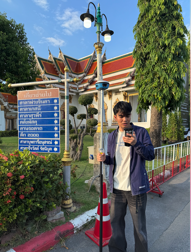
How X5 Laser RTK Enhances Surveying Accuracy
The X5 Laser RTK is another game-changer in the field of high-precision surveying. With a 50-meter effective laser range and two-centimeter measurement accuracy, it sets a new standard for precision. The dual-camera AR stakeout feature enhances field guidance, making it intuitive and user-friendly. Additionally, the contactless measurement capability improves safety and accessibility, especially in hard-to-reach or hazardous areas. These features make the X5 Laser RTK an indispensable tool for professionals seeking high accuracy and efficiency in their surveying projects.
Applications in Natural Resource Management and Urban Development
The applications of SpatiX’s H7 SLAM and X5 Laser RTK extend far beyond traditional surveying. In natural resource management, our technology enables precise mapping and monitoring of natural assets, helping to ensure sustainable management practices. In urban development, the ability to generate real-time 3D models and accurate spatial data supports efficient planning and execution of infrastructure projects. These capabilities are particularly beneficial in a rapidly developing country like Thailand, where accurate and up-to-date spatial data is crucial for informed decision-making.
Empowering Thai Professionals with High-Precision Tools
At SpatiX.ai, we are committed to empowering professionals in Thailand with the tools they need to achieve centimeter-level accuracy and drive efficiency in their critical projects. Our H7 SLAM and X5 Laser RTK devices are designed to meet the specific challenges faced by surveyors, urban planners, and natural resource managers. By providing high-precision, reliable, and easy-to-use solutions, we are helping to improve field data collection efficiency, reduce rework, and enhance safety and operational reliability.
In conclusion, SpatiX’s innovative surveying solutions are transforming the landscape of geospatial technology in Thailand. Our H7 SLAM and X5 Laser RTK devices are not only pushing the boundaries of what is possible in terms of accuracy and efficiency, but they are also enabling professionals to tackle complex challenges with confidence and precision. As we continue to develop and refine our technology, we remain dedicated to supporting the critical work of surveying, natural resource management, and urban development professionals around the world.
