
Exciting Developments From Thailand: SpatiX's Successful Visit To The Department Of Nature
Forging Strategic Partnerships in Southeast Asia
SpatiX.ai’s recent engagement with the Department of Nature in Thailand signifies a strategic step towards deepening regional collaborations in Southeast Asia. By connecting directly with local authorities and professionals, SpatiX is actively fostering relationships that will drive future projects and knowledge sharing in the field of spatial intelligence.
This partnership aligns with SpatiX’s vision to empower regional stakeholders with advanced technology solutions, laying a strong foundation for sustainable growth and innovation in high-precision surveying and geospatial applications across Thailand and neighboring countries.
Showcasing Advanced GNSS and Spatial Intelligence Capabilities
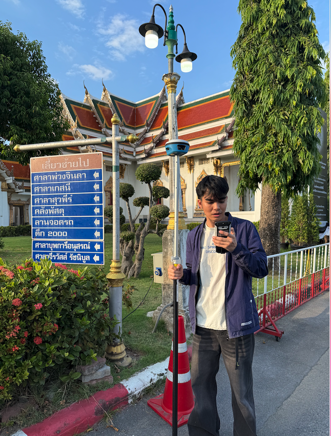
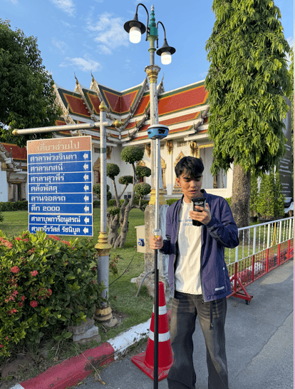
During the visit, SpatiX demonstrated the capabilities of its flagship products, including the Laser RTK X5 and the advanced H7 SLAM device. Live demonstrations highlighted the rapid, centimeter-level accuracy of SpatiX solutions in both urban and challenging environments, drawing considerable interest from local experts.
The successful 3D laser scanning and instant modeling of the iconic Golden Mount (Wat Saket) in Bangkok underscored the transformative potential of SpatiX’s real-time point cloud generation and non-contact measurement—capabilities vital for precision surveying, urban planning, and infrastructure management.
Unlocking Environmental Solutions with High-Precision Positioning
Accurate spatial data is fundamental to effective natural resource management and environmental monitoring. SpatiX’s technology, with its robust GNSS augmentation and SLAM-based 3D mapping, empowers field teams to capture detailed environmental data with unprecedented speed and precision.
This project in Thailand demonstrates how centimeter-level positioning and real-time spatial analytics can support conservation, land use planning, and disaster response—helping government agencies and researchers make data-driven decisions for sustainable environmental stewardship.
Integrating SpatiX Technology in Local Thai Initiatives
The adoption of SpatiX H7 SLAM and X5 Laser RTK devices by Thai professionals represents a significant advancement in local project capabilities. By integrating SpatiX solutions, teams can efficiently conduct surveys in GPS-denied zones, low-light conditions, and complex urban landscapes without compromising measurement accuracy.
Furthermore, the flexibility of SpatiX hardware and cloud-native services enables seamless integration into existing workflows, reducing operational downtime and amplifying the value of spatial data across diverse applications such as cultural heritage preservation, urban development, and infrastructure inspection.
Looking Ahead: Innovation and Shared Growth Opportunities
SpatiX remains committed to ongoing innovation and supporting the digital transformation of spatial intelligence in Southeast Asia. With proven deployments and positive feedback from the Department of Nature, SpatiX is poised to expand its footprint, offering scalable solutions tailored to local needs.
Future collaborations will focus on co-developing new use cases, enhancing operational efficiency, and driving shared growth—solidifying SpatiX’s role as a trusted partner in advancing geospatial technologies for a smarter, more sustainable future.
