

Exciting Developments From Thailand: SpatiX's Success With Laser RTK X5 And SLAM H7
Pioneering Precision: SpatiX's Breakthroughs in Thailand
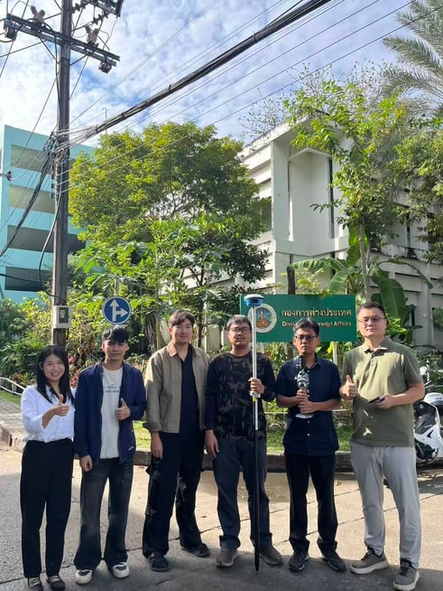
SpatiX has marked a significant milestone in Thailand's geospatial technology sector with its recent deployment of advanced positioning solutions. The SpatiX team's collaboration with the Department of Nature in Thailand not only demonstrated innovative product capabilities but also showcased a new era of spatial intelligence for the region.
Live demonstrations of SpatiX's latest hardware, including the Laser RTK X5 and SLAM H7, garnered enthusiastic feedback from professionals and officials. The successful 3D scanning and modeling of the iconic Golden Mount (Wat Saket) in Bangkok provided a compelling example of how state-of-the-art geospatial technology can be seamlessly integrated into cultural heritage preservation and urban resource management.
How Laser RTK X5 Sets a New Standard for Surveying
The Laser RTK X5 is engineered to deliver centimeter-level measurement accuracy with an effective laser range of up to 50 meters. Its dual-camera AR stakeout function introduces intuitive field navigation, allowing users to perform highly accurate, contactless measurements—even in hard-to-reach or hazardous environments.
By enabling professionals to achieve rapid, precise data collection, the X5 addresses longstanding pain points, such as unreliable positioning from traditional GPS and the risks associated with manual surveying in challenging conditions. Its robust performance and user-centric design are transforming the expectations for efficiency and safety in field surveying workflows.
Unleashing the Power of SLAM H7 for Efficient 3D Mapping
The SpatiX H7 SLAM device brings unmatched versatility to mapping operations. Lightweight and suitable for single-person operation, the H7 integrates multiple modes—including UAV, SLAM, and RTK—allowing users to adapt quickly across a wide range of field scenarios.
During the Golden Mount project, the H7's real-time 3D point cloud modeling capability delivered immediate, high-resolution spatial data, even in GPS-denied and low-light environments. This non-contact, rapid feedback approach not only improves operational efficiency but also ensures that cultural and natural assets can be digitally preserved with exceptional fidelity.
Seamless Integration for Real-World Challenges
SpatiX solutions are designed for interoperability and seamless integration with existing geospatial workflows and platforms. The combination of precise hardware, advanced algorithms, and cloud-native services enables real-time data processing and spatial analytics—critical for professionals managing complex natural resources, urban assets, and infrastructure projects.
With a focus on user experience, SpatiX technologies reduce the learning curve and minimize the need for extensive training, making high-precision positioning and 3D modeling accessible to a broader range of professionals in Thailand and beyond.
Driving Industry Transformation With SpatiX Technology
By empowering Thai professionals with cutting-edge tools, SpatiX is accelerating the transformation of key industries—ranging from natural resource management and cultural heritage conservation to urban development and construction.
The demonstrated ability to achieve centimeter-level accuracy, operate in challenging environments, and deliver real-time, actionable spatial intelligence positions SpatiX as a trusted partner for organizations aiming to enhance operational efficiency, safety, and decision-making across the geospatial value chain.
